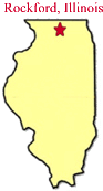
Getting There
The Bottoms
are made up of several individual conservation areas - Anderson Bend,
Distillery, and LIB - all located along the Kishwaukee River west of
Belvidere. An entrance from Distillery Road is located 2.5 miles west
of Belvidere on Business Route 20 and then 1.5 miles south on Distillery Road.
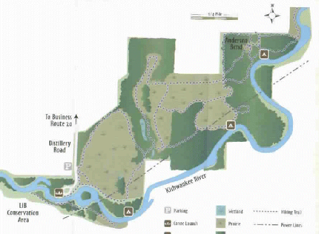
This accesses the cane launch, parking area, and both the Distillery and
Anderson Bend Conservation Areas. Click
here for a map.
Natural Considerations
These areas
lie on the banks of the Kishwaukee River and host flora and fauna typical of a
northern Illinois river bottom. Silver maple, sycamore, and willow trees
dominate lowlands adjacent to the river. These species are adapted to
withstand seasonal flooding. Low areas are dotted with wetlands which
provide ideal habitat for aquatic species, including turtles, frogs, and
beaver. Species of birds, including waterfowl and wading birds frequent
the marsh. Warblers utilize the area in the spring to rest and refuel
before continuing their journey north. Out of the floodplain are the oak
savannah forests which prefer better draining. Hardwoods including red
and white oak, and hickory trees dominate these ridges. These areas
support a healthy population of cavity nesting song birds due in part to the
efforts of a local birding enthusiast who places and monitors a variety of
nest boxes.
History
For
thousands of years, the Kishwaukee River was used by the Native Americans to
transport goods for trade. The name Kishwaukee is derived from the
Potowatomi word meaning "river of the sycamore". Potowatomi
Indians utilized large sycamore trees found in the valley for dugout canoes.
The river also designates the northern most natural range of the sycamores.
In most
recent history, the area was used for agricultural purposes until the 1970's
when it was acquired by the Conservation District.
Opportunities for fun
Over 547
acres of wild land exists here and contains very little development, so they
opportunity to tune out society and connect with nature is available.
Hikers and skiers can utilize the 7.6 miles of trails which wind through
prairies, woodlands, and wetlands. Canoeing enthusiasts can take
advantage of the launch site which provides ease of access to the water.
Activities and Facilities
Hiking
trail, cross country skiing, restroom, canoe launch, fishing.